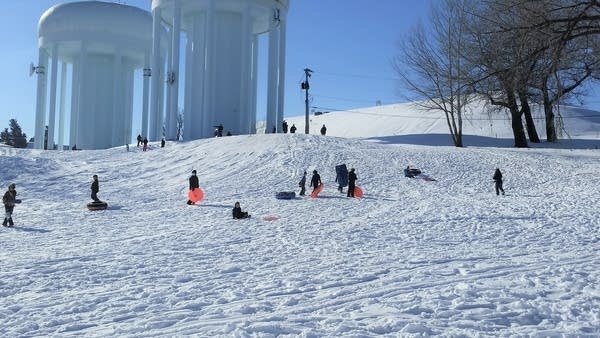
Sunday in St. Paul
Ron Trenda/MPR News
Our Sunday afternoon weather was great for playing outdoors. I saw cross-country skiers and kids with sleds enjoying the fresh snow that fell on Saturday.
The high temperature at Minneapolis-St. Paul International Airport was 29 degrees on Sunday. That was 5 degrees warmer than our average Jan. 24 high temp.
Dry for a few days
It looks like Minnesota will avoid the winter storm that hits parts of Nebraska, Iowa and northern Illinois on Monday.
The National Oceanic and Atmospheric Administration’s North American Mesoscale (NAM) forecast model shows the potential precipitation pattern for Monday afternoon through Tuesday morning:

Simulated radar Monday afternoon through Tuesday morning
NOAA, via Tropicaltidbits.com
Far southern Wisconsin will also see some snow.
Northwestern Minnesota will have a chance of light snow showers Monday morning, but most of us won’t see any flakes Monday or Tuesday. One model hints at a few stray flakes on Wednesday. Check forecasts later this week; we may see a mix of rain and snow in some areas next Saturday.
You can hear updated weather information for Minnesota and western Wisconsin on the MPR network, and you’ll see updated weather info on the MPR News live weather blog.
Temperature trends
Monday highs will range from single-digits in northwestern Minnesota to 20s in southeastern Minnesota and western Wisconsin:

Monday forecast highs
National Weather Service
A few spots in the Twin Cities metro area could creep above 20 degrees.
Monday will be a bit breezy, with gusts of 14-18 mph in many locations by afternoon:

Monday noon forecast wind gusts
National Weather Service
Plotted wind gusts are in knots, with 14 knots equal to about 16 mph.
Back to temperatures, Twin Cities metro area highs are projected to be around 20 degrees on Tuesday, followed by lower 20s Wednesday and mid 20s on Thursday. We could hit 30 on Friday.
Mild (for January) temps may be with us next weekend and into the start of the following week. The NWS Climate Prediction Center shows a tendency for above-normal temps in Minnesota and western Wisconsin from Jan. 30 through Feb. 3:

Temperature outlook Jan. 30 through Feb. 3
NWS Climate Prediction Center
We’ll see if that pans out.
Bright outlook
People who enjoy a bit of daylight at the end of their work day will be interested to know that sunset is now at 5:10 p.m. in the Twin Cities. One month from now our sunset time will be at 5:44 p.m., a full 44 minutes later than today!
Programming note
You can hear my live weather updates on MPR News at 7:35 a.m., 9:35 a.m. and 4:39 p.m. each Saturday and Sunday.
You make MPR News possible. Individual donations are behind the clarity in coverage from our reporters across the state, stories that connect us, and conversations that provide perspectives. Help ensure MPR remains a resource that brings Minnesotans together.
"later" - Google News
January 25, 2021 at 07:18AM
https://ift.tt/3qS6Vfl
A cool Monday, temps rebound later this week - Minnesota Public Radio News
"later" - Google News
https://ift.tt/2KR2wq4
Bagikan Berita Ini


0 Response to "A cool Monday, temps rebound later this week - Minnesota Public Radio News"
Post a Comment